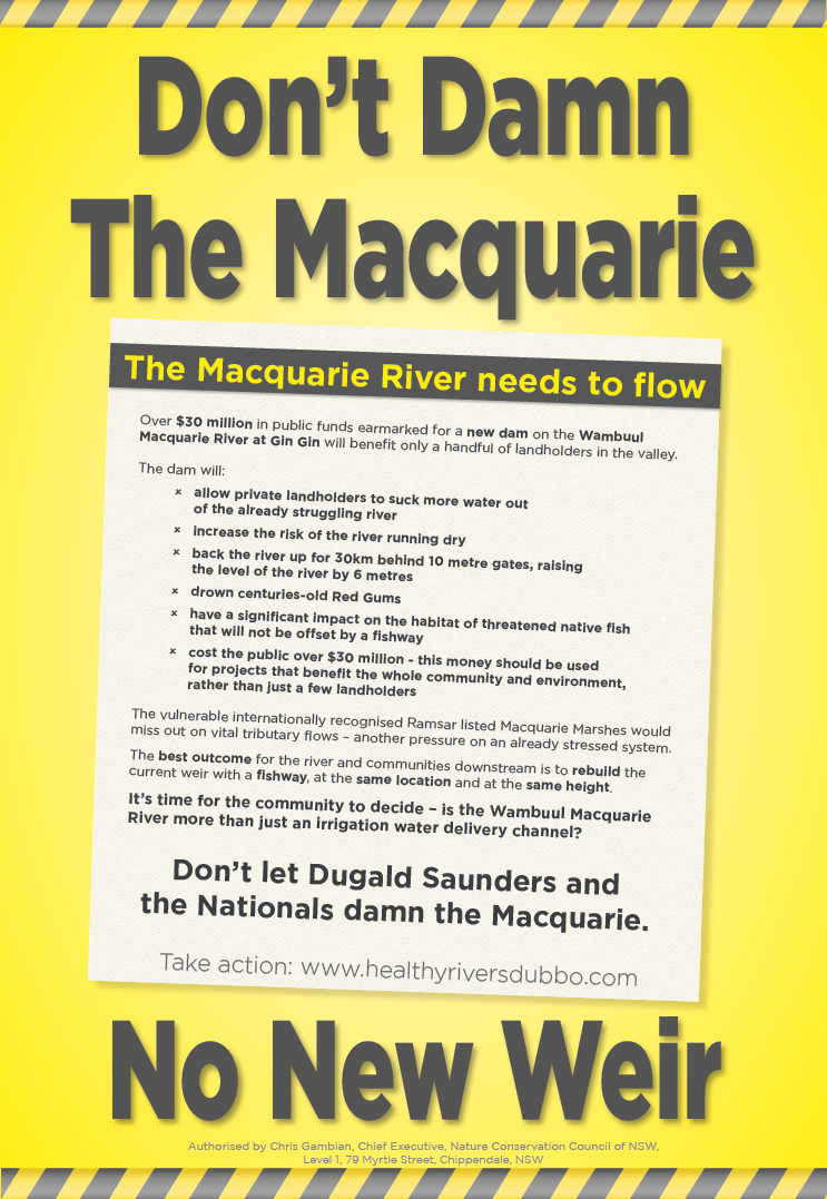
Macquarie River reregulating storage project
Submission Guide: Inquiry into the rationale for, and impacts of, new dams and other water infrastructure in NSW – focus on Macquarie River reregulating project.
This inquiry is into the following projects: Wyangala dam wall raising, Mole River dam, Dungowan dam, Macquarie River reregulating storage project and the Western Weirs project. This submission guide refers specifically to the Macquarie River reregulating storage project. Please make that clear in your submission.
Submit Online: Upload Submission Document Here (fill out contact details on the first screen. Elect if you want your submission public on the second page. Upload a document on the third page).
Deadline: CoB Tuesday 22nd September 2020
For more details, see the full terms of reference: ToR
_________________________________________________________________________________________________________________________
Points to make about the Macquarie River reregulating storage project:
a) Fix the rules instead of building the project:
- Water that isn’t in Burrendong is allocated to customers. Only water that is physically in Burrendong should be allocated. That would decrease the risk of the river and towns in the valley running out of water.
- The NSW Government only look at drought records from before 2004 when working out water allocations.
- WaterNSW only deduct the volume of water a customer pumps, not the volume they order. If they deducted what they ordered, there would be no need to build this structure.
- Some types of environmental water and unregulated flows, including inflows from the Talbragar, Bell and Little Rivers, could be captured by this project. There should be consistent rules across the Murray Darling Basin that protect all types of environmental water from extraction.
b) The economic rationale for the project:
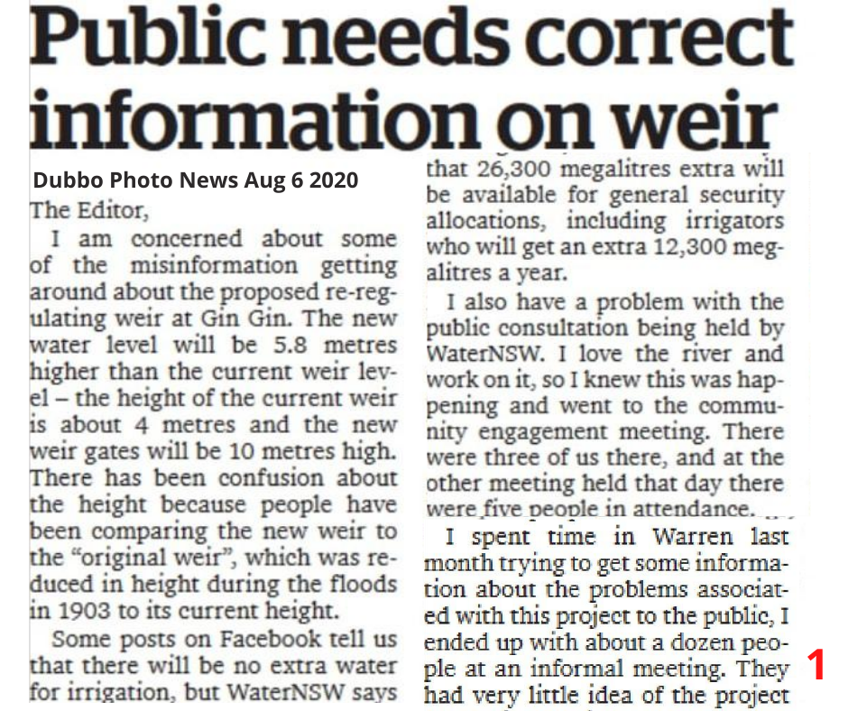
- The public don’t know the estimated cost of the project, we only know it is at least $30 million dollars because it’s classified State Significant Infrastructure.
- The final business case will not be made public, despite a public promise from the Member for Dubbo Dugald Saunders MP.
- The volumes of extra water for general security customers, and the cost of the project will be in the final business case, those critical figures will not be available to the public.
- The Member for Dubbo stated there would be “not one drop of water extra that goes to irrigation”, however increasing the volumes available for general security customers is an objective of the project.
- There will be no high security town water licences held in the storage.
- The extra water for general security will be coming from flows that are currently a type of environmental water. The environment will have much less water, even though there will be small increase in water available to the general security environment account.
- Only general security irrigation customers will benefit from this project.
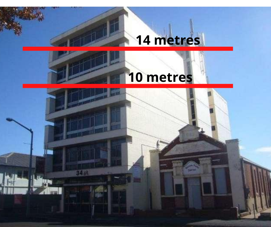
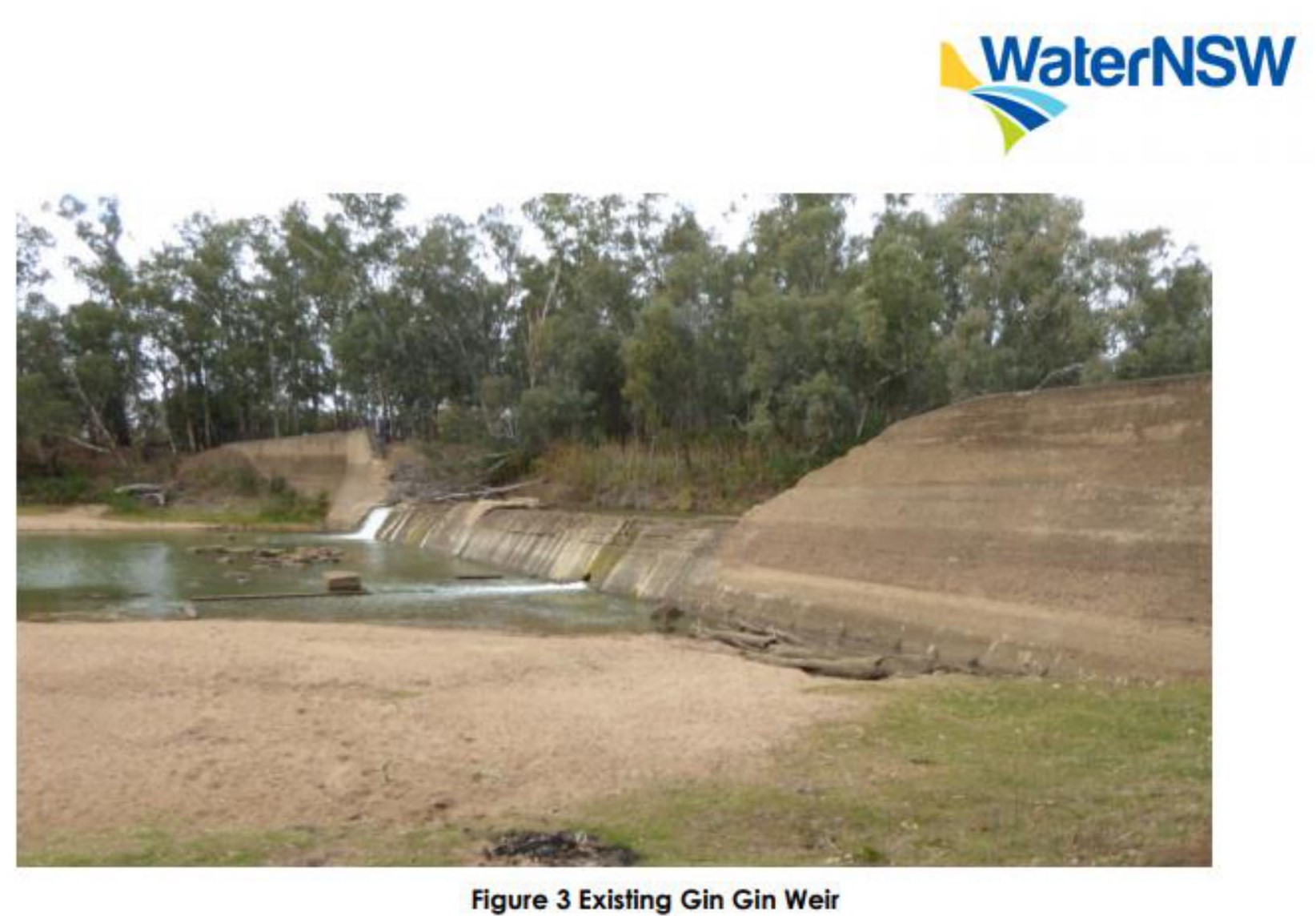
- WaterNSW have had a legal obligation to construct a fishway at Gin Gin since 2011. The design has been done. WaterNSW should just install a fishway and reinforce the current Gin Gin weir instead of constructing a very large expensive new dam.
- There is no sound socio economic case provided for this project.
c) The environmental and socio-economic impact:
- A registered aboriginal heritage site will be destroyed.
- The socio-economic impact of reduced flows downstream of Marebone weir will not be considered. Grazing, unregulated irrigation and tourism opportunities will be significantly negatively impacted by the project.
- Towns like Warren and Carinda will be at an increased risk of the river running dry again.
- Gin Gin is a very popular recreational site.
Water
- Unregulated, natural flows including flows entering the river from the Bell, Little and Talbragar Rivers are critically important for aquatic native animals and fish to breed, feed and migrate.
- Natural flows carry nutrients, occur when the atmospheric conditions are just right, and are the correct temperature.
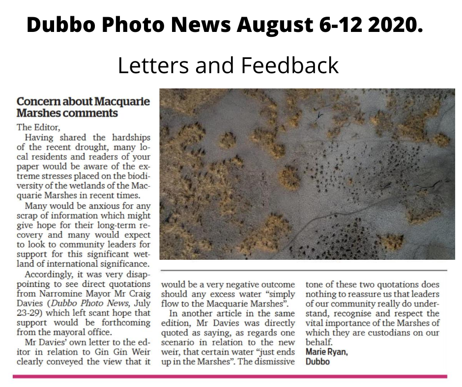
- There will be drier conditions downstream, including the Macquarie Marshes. This will mean it will be a lot harder for the Macquarie River to connect to the Barwon-Darling Rivers.
- The 30km weir pool will mean reduced water quality and increase erosion.
Marshes and migratory birds
- The internationally significant Ramsar listed Macquarie Marshes are one of the most important waterbird breeding sites in Australia. Australia has a legal obligation to protect Ramsar wetlands.
- A notice of “change of ecological character” was issued in 2010 because the condition of the Macquarie Marshes had deteriorated so much. The main reason for the notice was a change in flow regimes.
- This project can only exacerbate the ongoing decline in the health of the Macquarie Marshes and therefore the habitat for 14 species of migratory birds, 10 colonial-nesting species, and a total of 233 native species of birds including 77 species of waterbird, some of which are listed as critically endangered.
- The Marshes also provide habitat for 60 native reptile species, 11 species of native fish, 29 native mammals, 15 native frogs and 324 native plant species.
- More details Professor Richard Kingsford submission to the EPBC referral here
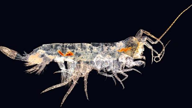
Native fish and the riparian zone
- The habitat of native fish listed as endangered and critically endangered under the NSW Fisheries Management Act and the Federal EPBC Act will be significantly impacted.
- One of the last remaining significant Murray Cod breeding sites on the Macquarie is immediately downstream of the proposed dam.
- The 30km weir pool would mean a loss of riffle zones, snag habitat, the inundation of spawning and recruitment sites. Details in the EPBC referral.
- A 30km long weir pool of still water will cause Murray Cod eggs to sink and die.
- The vegetation along the river, including centuries old River Red Gums, will likely drown due to extended periods of inundation.
- The frequent fluctuations in water level will not provide vegetation or biofilm a suitable hold. Over time, this will mean the weir pool will not support a food web for native fish, reptiles, waterbirds or any other aquatic animals. Dr Martin Mallen-Cooper’s comments.
- Transforming a moving part of the river to a still pool will suit carp and mosquito fish.
- Fish passage at Gin Gin is very important and overdue. The compulsory fishway component of the re-regulating structure will not ameliorate the significant impacts the project would have on the habitat of threatened and endangered native fish and other aquatic animals.
- Native Fish in the Macquarie River are already listed as an Endangered Ecological Community.
f) Other matters:
- The project will likely have significant impacts on matters of national significance, and should not be assessed by the NSW Government who are the proponents of the structure, this is a clear conflict of interest.


 Mel understood that while WaterNSW were saying they would reduce the height of the gates, the official documentation had not changed, so called John Laws back with serious concerns that the Member for Dubbo didn’t understand the scale of the project.